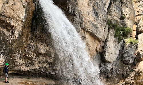
The hike to Fanes waterfalls (in Italian, Cascate di Fanes) is one of the most beautiful and panoramic in the valley of Cortina d’Ampezzo. It is one of the best hikes in the Dolomites, especially for beginners.
There are multiple accesses to the valleys of Fanes and Travenanzes, as well as different directions to follow the trails. In some parts, you are surrounded by the forest, and others instead require climbing the bare rock (in Italian, this is called “Via Ferrata“, a trail with metal cables on the side of the mountain. Equipment is required.). As the name suggests, the key attraction is a high, spectacular waterfall; before and after, the peaceful sound of the stream will keep you company.
In this post, we will detail three trails: an easy and panoramic one, a hard but satisfying one, and an alternative one. They are all self-guided hikes. I also recommend this official resource, even though it makes the hike seem easier and shorter: our three trails are all included in their “Part One”, which was definitely enough effort for me.
Are you a couch potato? So are we! Nonetheless, when we do manage to get up from our lovely sofa, we enjoy spending time outdoors. We share our super-easy hikes, stories and adventures on our series “Hiking for couch potatoes“. If we can do it, you can do it too!
Where are Cascate di Fanes?
The Fanes valley is located North of Cortina d’Ampezzo (map here). The famous, high waterfall is in a gorge quite at the beginning of the trail; afterward, the valley continues upwards, along the stream.
It is part of the Dolomiti d’Ampezzo Natural Park.
How to get to Fanes Waterfalls?
We recommend the access point “Ponte Felizon” at the kiosk that marks the entrance to the Dolomiti d’Ampezzo park (map here), close to Spiaggia Verde (a beach by the Boite River).
You can reach it:
– by car (leaving the main road towards Dobbiaco after Fiames, exactly here, to the left,) and park in the parking lot right in front of it
– by bus n.1 from the city centre until Hotel Fiames (last stop), and then walk approx. 30 minutes
– by bike, and you can continue cycling inside the park (the road is large enough for a car; some parts are really steep).
When is the best time to hike to the waterfalls?
The park is open all year, but it is not always monitored. You hike at your own risk.
The best period for hiking to the Cascate di Fanes is from April/May to September. In the spring, the waterfalls are particularly full of water from the melting snow; in the summer, it may be crowded, but also warm and pleasant (we did it in August); in the fall, it is less crowded and the foliage makes the forest even more special.
We recommend starting at 9-10 AM for the hard or the alternative trail. The easy trail is very short, so just make sure you start 2 hours before sunset, in order to have time to get back.
Also, do not go too late in the afternoon and risk being alone if something bad happens.
During the winter, the hike may not be accessible because the cross-country skiing track is built there.
How long does it take?
All trails we describe below are loops: you will start and finish at the entrance, where the parking is. Also, these are couch potato times: we walk easily and we take lots of pictures.
The easy, panoramic trail goes from the entrance to the viewpoint and back: with our walking pace, it takes approx. 1,5-2 hours in total (to get there and back). It’s really more of a walk than a hike.
The difficult but satisfying trail goes to the famous, high waterfall, climbs down the gorge, then up to the viewpoint, and back to the entrance (it is also possible to do it the other way round): it takes approx. 4 hours in total to get there and back (including taking lots of pictures). Basically, the difficult trail includes the easy trail.
The alternative trail walks next to the high waterfall and then continues upwards through the woods, along the stream, waterfall after waterfall, and then comes back on the main road inside the park. We did only half of it because we wanted to climb down the gorge, and it took us 3 hours. The full trail probably takes 4 hours, to get there and back.
What equipment do I need?
If you plan to do the easy, panoramic trail, you just need comfortable shoes with a good sole, and possibly some water and a snack. The trail is almost all flat and very easy.
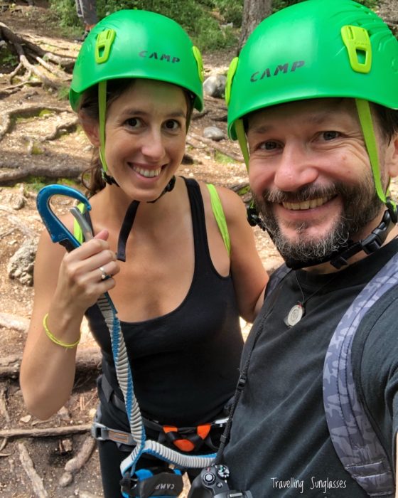
The hard trail and the alternative trail, instead, are a “Via Ferrata” with metal cables. It is compulsory to bring equipment: helmet, harness, carabiner at least. You can rent it for the day from many shops in Cortina, such as Snowservice and Rock and Ice (where we rented from, for 16 EUR per person.)
Bring with you the basics:
– some water
– a snack (or a sandwich if you do the hard or alternative hike)
– paper tissues
– plasters (for unexpected blisters)
– an empty bag to collect whatever trash you see around. Take care of the planet!
Wear comfortable clothes; I was slightly cold in the shadow of the forest and under the waterfalls, so I suggest a jumper.
Who can and who should not do this hike?
The easy trail is perfect for anybody, from children to grandparents, in all levels of fitness. I think an Australian could even do it with flip-flops!
The hard and the alternative trail require a minimum level of fitness; it is actually a recommended trail for people who have never done a via ferrata before. I’ve seen children do it, as well as people in their 60s, but I personally had a hard time.
Some parts of the hard and alternative trail could also be tricky for people who are afraid of heights: when you’re attached to the metal cable, but the trail is open to the gorge on one side, or you’re walking up/down the iron ladders.
Trail 1: the simple, easy trail for Cascate di Fanes viewpoint
This easy hike to Fanes waterfalls is perfect for everybody, also for young children or elderly people.
Starting from the hut described above, follow the road into the valley for approx 30 minutes. This area is called Pian de Loa. The road is paved and wide enough for a car.
Shortly after crossing a small bridge, you will reach a fork in the road. Take the right and follow the sign “Pian de Loa, Cascata Belvedere”, which is the viewpoint.
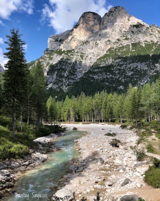
The path now becomes more narrow, made of gravel or dirt, winding between meadows and trees.
After approx 30 minutes more, you will reach the viewpoint. The impressive waterfall is such a sight, tall and majestic. Also, look on the other side of the gorge: that’s the hard trail, the one that takes you under the waterfall!
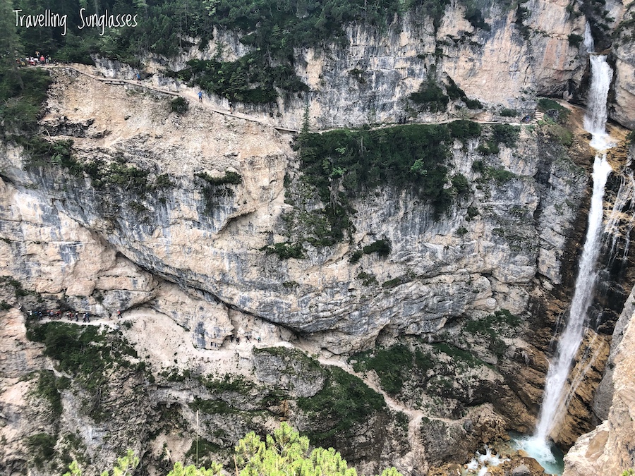
Come back the same way to the parking lot.
Trail 2: the hard trail to Fanes Waterfalls
The hard trail leads on the side of the canyon and then down into it. You get to walk under the famous waterfall, down the side next to it, and then back up to the viewpoint of the easy trail. It’s also possible to do it the other way round: first to the viewpoint, then down to the bottom of the gorge, and then up and under the waterfall. It took us approx. 4 hours.
We decided to do this trail because it’s the most famous one, and also because I remember doing it when I was 13 or so… It wasn’t that hard! Well. This time, as a 30-year-old couch potato, I was definitely not in shape for it! If you also are not trained, if you do very little physical activity like me, this may be quite hard. Darek, who goes to the gym 2-3 times a week, was perfectly fine all along.
Start from the hut (access point described above) and follow the road into the valley for some 30 minutes. At the fork, take the left (the sign says “Ponte Outo, Cascate Sent. Ferrato”) and follow the dirt road, as it starts climbing up slowly. It’s so relaxing to walk among the trees, and the explanations about the flowers and plants make it very interesting.
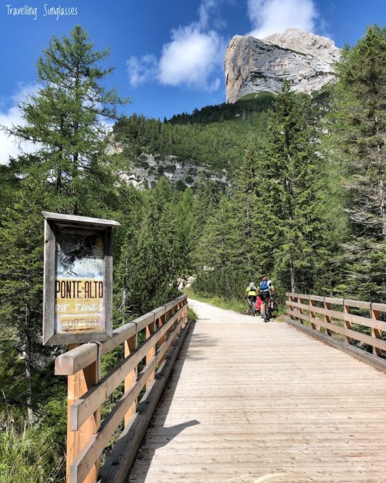
After 20 more minutes, you will reach the impressive Ponte Outo/Ponte Alto, the high bridge, which crosses a gorge, 80 meters above the confluence of Rio Travenanzes and Rio Fanes streams. It’s a spacious and stable wooden bridge; if you’re scared of heights, just walk in the centre. The view below is quite spectacular, you truly feel part of the mountains surrounding you!
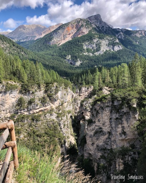
You are now at 1380 meters above sea level. Isn’t that satisfying? Right after the bridge, there is a convenient resting spot with some tables: take a break, eat a snack, and wear the gear.
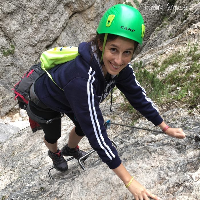
The trail that descends into the waterfalls canyon starts here (on the sign: Sentiero attrezzato alla cascata). Now it is time to attach yourself with the carabiner to the metal cables of the Via Ferrata. It’s such an exciting part of the trail: I was nervously locking myself to the rock on the left, but also admiring the scenery on the right, and looking forward to reaching the waterfall.
Reaching the waterfall is so spectacular and breathtaking! Even though the rocks underneath the water are slippery, I felt safe walking under the spraying water, as I was attached to the cables.
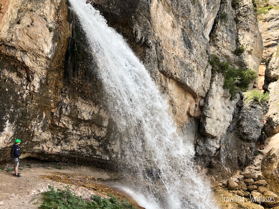
Afterward, the trail continues down the gorge. Some rocks require big steps, and in some spots they are slippery with water, but it’s all quite exciting.
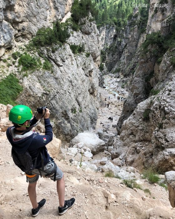
The hard part for me came here: the descent to the bottom of the waterfalls requires climbing down an iron ladder, cast in the rock. While Darek was really relaxed and enjoying the hike, I really underestimated this effort and finished the ladder almost shaking. Perhaps I was just more tired than I thought, as there were plenty of people around me, even kids, all pretty chill!. Anyways, the iron cable of the via ferrata continues next to the ladder, so it’s perfectly safe to attach yourself to it as you climb down.
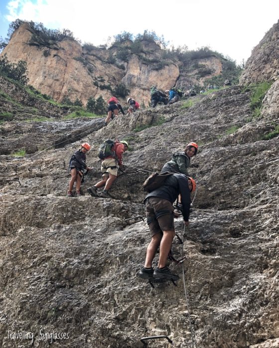
The view at the bottom of the waterfall and gorge is glorious and absolutely worth it. It took us 1 hour to climb from the top to the bottom of the canyon, including some queueing before the iron ladder, where a group of hikers was coming up and another group was going down. It was a very welcome break 🙂
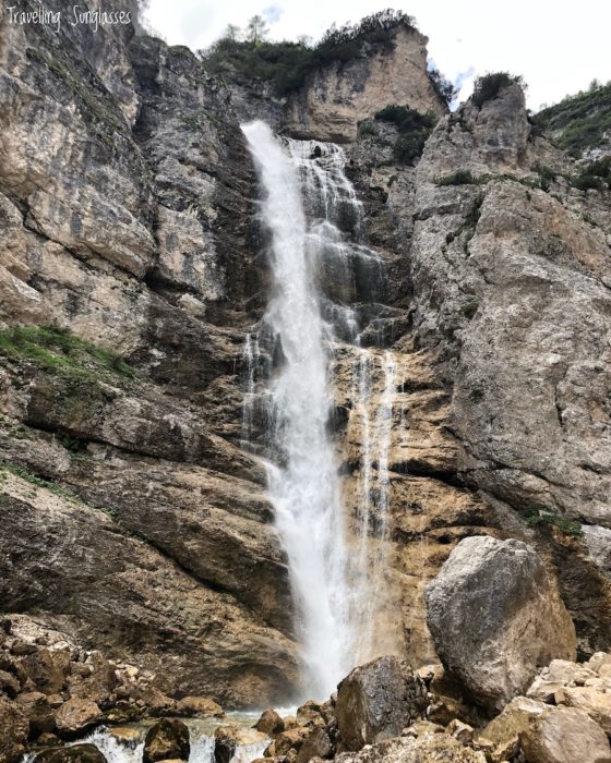
Here you have a choice: take the right path up back to the starting point (Ponte Outo, the high bridge), or take the left path and reach the viewpoint. Either way, it’s a pretty tough way up; this is a good spot for a snack and to rest a little.
We chose the left path and reached the viewpoint in approx. 30 minutes. The awesome view of the Fanes waterfall and canyon was really rewarding!
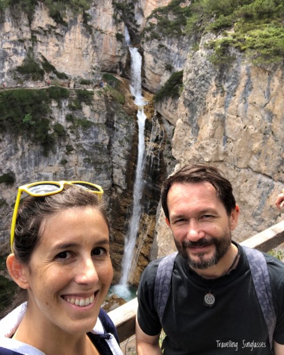
We walked back to the parking lot in approx. 1 hour along the easy trail described above: just a few ups and downs, surrounded by trees and meadows, a really pleasant and enjoyable trail.
Trail 3: the alternative trail
The alternative trail is the Path of Canyons and Waterfalls. It walks up the valley after Ponte Alto, along the stream, waterfall after waterfall (not as majestic and high as the famous one, but still very impressive), in the woods. It is a very pleasant hike (but always upwards) and much less crowded.
From the starting point at the parking and hut, follow the main road, take the left at the fork by the bridge (follow the sign “Ponte Outo, Cascate Sent. Ferrato”), until the bridge of Ponte Alto.
At the resting area with the tables, follow the signs towards Val di Fanes. The trail becomes quickly quite steep. At the next sign, follow “Sentiero dei canyons e delle cascate”, literally “Path of the canyons and of the waterfalls”.
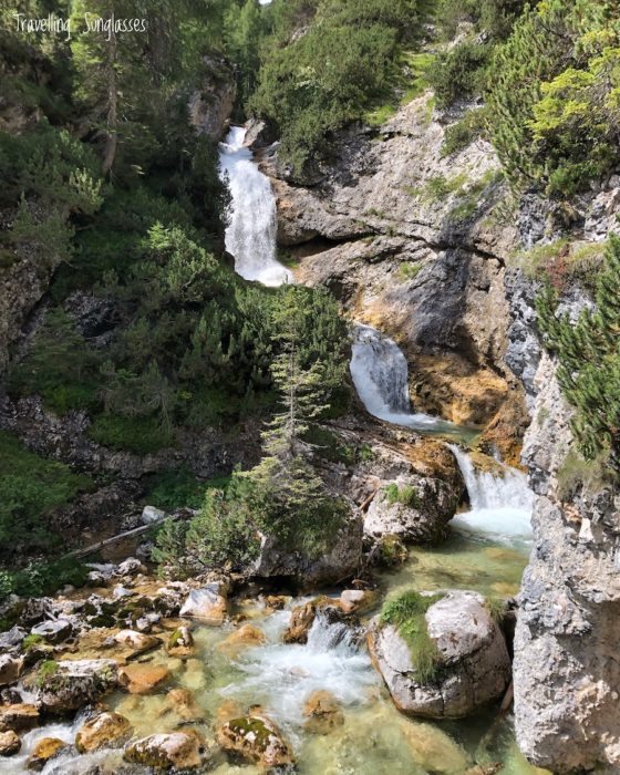
We spent approx 40 minutes walking upwards along the path, across the stream of pure, fresh water, up some metallic stairs (perhaps a little scary-looking, but very feasible), up along the pure mountain rock.
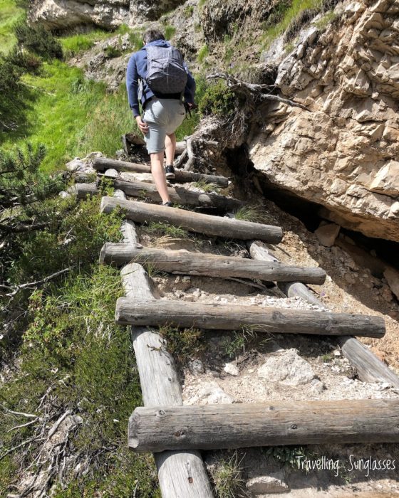
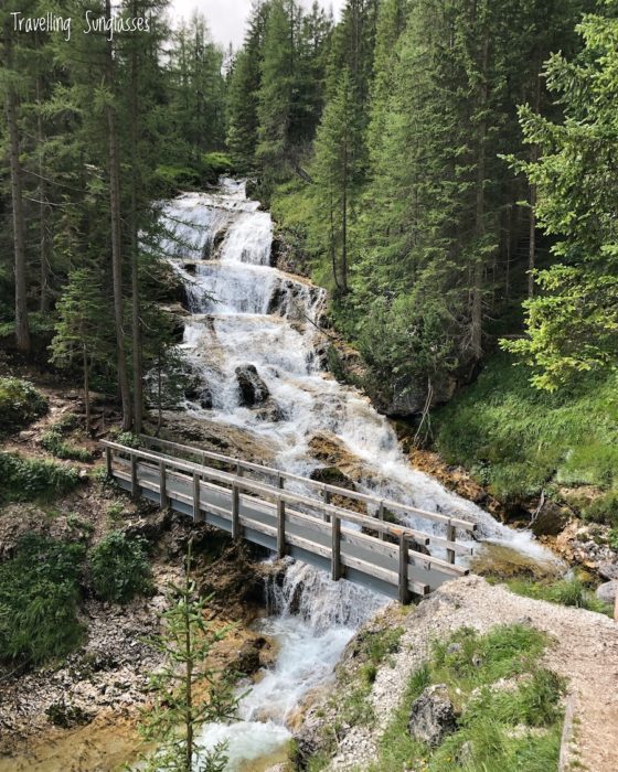
We took a break at this huge waterfall. I was already a little tired, and we still wanted to climb down the famous waterfall in the gorge, so we decided to turn back: in some 20 minutes, we reached the resting point where the via ferrata down the waterfall canyon starts. So in total, this part of the alternative trail took us 1 hour.
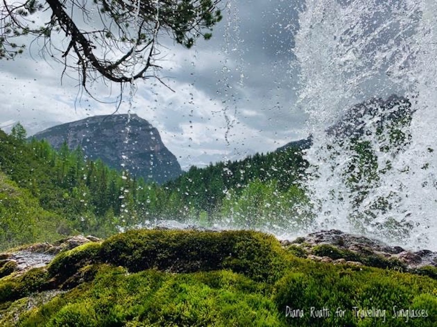
However, I was later told by my friend Diana that the trail just becomes more and more magnificent after this waterfall. When she did it in April, she took some amazing pictures! I love this shot from behind the final waterfall, called Sbarco de Fanes (harness gear is necessary for this part). Next time, we will definitely do the whole trail! I expect this would add 1 more hour.
Conclusion: our experience at Fanes Waterfalls
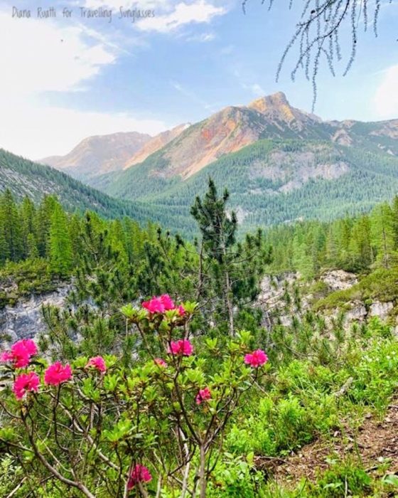
We really enjoyed the hike to Cascate di Fanes: the scenery was absolutely beautiful and peaceful. We felt immersed in nature, thanks to the perfect combination of woods, open meadows, and streams.
I also appreciated reading information about the plants and animals of this valley, as well as some geological details about the mountains around us.
In August, it was crowded only in one spot, in the main waterfall canyon.
During the hike, I could feel the physical effort and I felt a little overwhelmed a couple of times in the waterfall canyon. I had sore muscles for 3 days! Sore muscles meaning that sitting down and getting up was a little painful. (This did not prevent us from hiking to Croda da Lago the day after).
Overall, we would definitely do this hike again.
Are you planning to hike to Fanes Waterfalls, or have you been there already? Let us know in the comments!

hi, did you guys do the hard and “alternative” hikes a the same day?
would love to hear if its is possible to mix the 2 hikes in 1 day.
thank you!
Hi Ziv, yes, we did a piece of the alternative trail and the hard one on the same day. After the high bridge “Ponte Outo” there is the fork: to the right you go down the canyon, and to the left you keep walking up the valley, next to the stream and the waterfalls. We kept walking up, but we came back pretty soon. I don’t know how long it would take to go all the way up, and then back down to the fork at the bridge. I think that if you leave early enough and take breaks, you should make it! Depending on your level of fitness, you might be pretty tired to handle the climb down the waterfalls. Stay safe and let me know how it goes 🙂