When I started wondering how to use Maps.me, I wasn’t even convinced about switching from Google Maps. After all, I’m more of an urban traveller, while Maps.me is great for hiking, right?
Well, luckily, my friend, experienced travel blogger, and off-the-beaten-path explorer, Megan, from Packing Up The Pieces, accepted my invitation to show to all of us how Maps.me works, how she uses it to plan her adventures, and how it improved the way she travels. Guess what? I have already downloaded it on my phone, and I plan to use it on my couch-potato hikes!
Check it out, and let us know in the comments what you think about Maps.me.
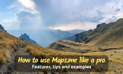
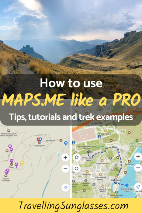
Maps.me may just be the single most essential app that every traveler needs to download on their phone. Yes, that’s right, switching to this offline map completely transformed how I traveled and continues to amplify how I see and explore the world. It also plays a significant role in how I plan some seriously epic multi-day treks and hidden gem day hikes. This app is a game-changer for those travelers looking to get a little more “off the beaten path.” Discover how to use Maps.me to create your own adventure.
Find out why you should download this free application and why it’s better than Google Maps. Follow along with a brief tutorial on how to use Maps.me and how to utilize all of its awesome features. I’ll share my best tips on using Maps.me for trip and adventure planning.
Here’s how to use Maps.me like a pro.
Why Maps.Me?
Easy. It’s the best offline map out there, no questions asked. I’ve been using Maps.me since 2015, and it’s been a complete game-changer on the way I see the world. The best part is, this helpful app is free, and it’s only getting better and better. Maps.me is always improving and increasing their already useful features.
The offline maps contain tons of useful information, from roads, hiking trails, and bike paths. In larger cities, find subway and taxi route options. However, in my humble opinion, Maps.me is best utilized by those who will be traveling by car, hiking, or biking and making use of the awesome offline features.
Maps.Me Tutorial & Other Fun Features
So, let’s break down those awesome offline features that Maps.me offers.
Downloading an Offline Map
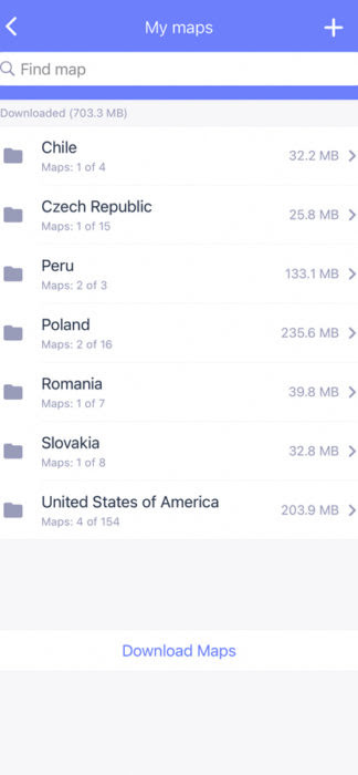
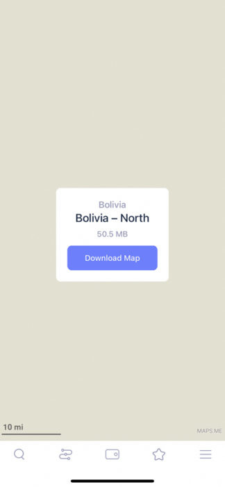
Maps.me has some seriously detailed offline maps. For that reason, most countries are broken into regions. As you can see, Peru has three regional maps, while the United States has 154 regional. To save on space, I usually just download the region I’ll be visiting. When the app opens, just head to the search key and start typing or visit the three lines in the bottom right corner to access the menu.
Pro-Tip | As you zoom in on a section, Maps.me will prompt you to download the offline map to see the details.
Route Planning
Great! Now that your offline map is download, you can start planning.
City Features
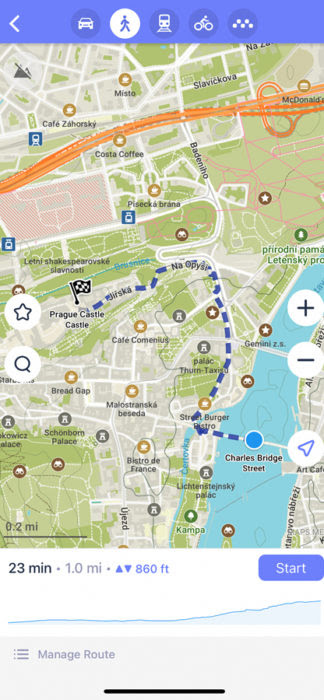
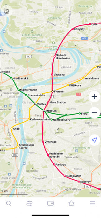
This app is handy in large cities to find the easiest walking route from point A to B. You can decide whether to map to or from a destination. It’s great because you can easily move navigation options between car, walking, and biking routes. If you’re in a larger city, you can turn on the Subway Map layer (upper left-hand corner).
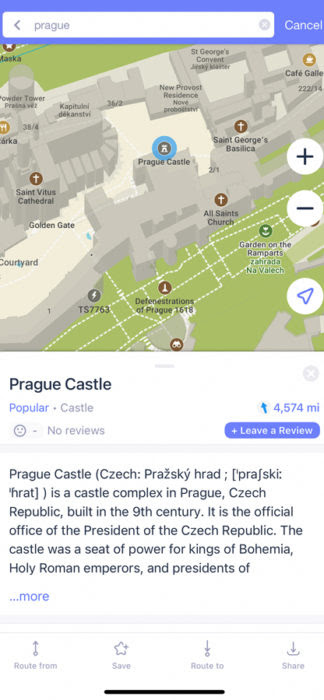
A newer feature is more popular destinations now have detailed descriptions imported from map users or Wikipedia. Also, there are now more user reviews of hotels, guesthouses, and restaurants. Just click on it and see the average guest rating and detailed critiques.
Countryside Features
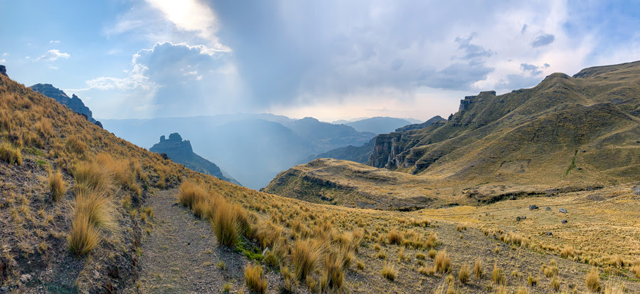
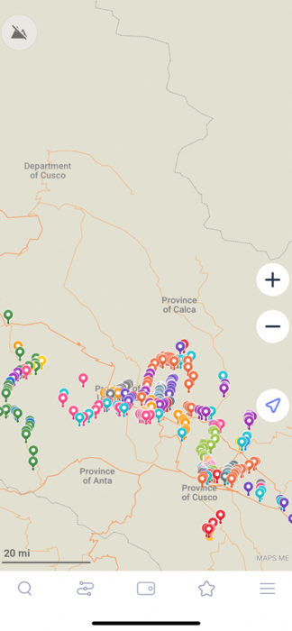
While it works great for city itineraries, Maps.me is a game-changer for adventure hikers. It’s easy to go in and plan a whole day or multi-day trek. The maps usually include essential details like information markers, water sources, viewpoints, mountains passes, and camping options.
The one critique I would give Maps.me is that extreme hikers may be disappointed in the lack of detail when it comes to elevation. There can be two trails that appear to be “next” to each other on the map, but in reality, there could be a gap of 1,000 meters between the two trails. Keep this in mind.
Pro-Tip | To save on battery life, make sure to not click start navigation. The route can be followed without using the voiceover and step-by-step directions. This helps save on battery life and is essential for multi-day trekkers who are relying on these offline maps.
Pre-Existing Map Files
Many hiking applications, like Wikiloc, have already made map files. Like a trail? These can easily be downloaded and ready to use on Maps.me. Simply download the route as a KLM file directly into Maps.me on your phone. All the waypoints will be already marked and the trail a solid line to follow.
Bookmarks
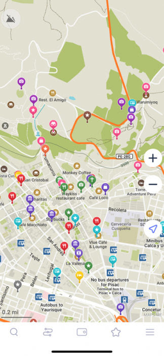
If you love a destination or want to visit it on your trip, bookmark it! It’s as easy as clicking on the place and hitting the star for save. What’s great about the bookmarks is there are over 16 colours to choose from, and you can create a plethora of Bookmark sets.
Pro-Tip | I try to stay organized by using specific colors for certain things. For example, I mark all my bus stations in the color cyan, guesthouses are in yellow, and so on…..
It’s easy to remove and see certain bookmark sets. For example, if you click on the star, it will show all of the bookmark sets and how many bookmarks are in each set. You can clear them off your visible map by clicking and un-clicking the purple check mark. That way you don’t lose all your notes and bookmarks, but it can reduce the clutter on your map.
Sharing Location
Another great feature is you can share your location with fellow travelers. Want to meet up with new friends from your guesthouse and share a coffee? It’s as easy as clicking on the three-line menu on the bottom right and hitting share my location. Everyone traveling seems to have WhatsApp and Maps.me is compatible with it.
Map Layers
Map layers is a new feature that I haven’t quite played with, but it makes it easy to see the subway lines in larger cities.
New Features
Maps.me is always improving and adding new features. They are starting to roll out guides for popular cities and locations. Some of these guides are free, while others must be purchased.
How to Use Maps.Me for Trip Planning
What is the first thing I do once I’ve decided on a travel destination? I head over to Maps.me and download the map for the regions and countries I’ll be visiting. After I purchase my plane ticket to my destination, I always book my first night in a locally run guesthouse. Maps.me is great to use and is essential in how I will reach my guesthouse. It’s perfect because most times I am traveling internationally and won’t have Wi-Fi or a SimCard, but my route is already planned.
This is how to use Maps.me to plan a city trip.
In my trip planning, I had already bookmarked where I want to go and what I want to see. This makes it easy because if I’m out exploring a city, all I have to do is click on a destination and my route will be planned. No internet needed!
As I stated above, I try to colour-code all my destinations I wish to see. All my bookmarks are saved to set, usually the name of the city. For example, all my restaurants will be in red and then I name the Bookmark by the city or country I am visiting.
How to Use Maps.Me for Adventures
Maps.me has allowed me to get off the beaten path and really explore places not on the tourist path. Many adventure hikers don’t prefer using a guide and would like to appreciate nature at their own leisurely time pace. This is where the awesome offline maps and features come in.
Here’s how to use Maps.me to plan hiking routes.
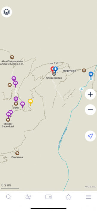
The internet is filled with tons of helpful resources, so research a route as best as you can. Go to Maps.me and start looking at the hiking paths. What I’ve noticed is that the black dashed paths are more commonly used trails, whereas the white dashed paths may not be used or are incomplete. I’ve once had where a white dashed path was non-existent, so I try to keep to the black dashed path. Go in and bookmark essentials, like campsites, water sources, passes, and points of interest. What I usually do then is name the bookmark set with the name of the trek.
Pro- Tip | I keep all the bookmarks for each hike the same color, but I always use blue to bookmark water sources.
After that, I am able to go in and see the rough kilometre distance, the estimated time between points, and the change in elevation. It’s important to note that the time is usually off, but the more you use Maps.me, the more you’ll be able to gauge its efficiency.
Help the Hiking Community | The reason Maps.me is so successful is that the community helps maintain and update the offline maps. In the right-hand corner, the three dashed menu bar has the option to “Add a place on the map.” While hiking, I use this feature a lot. If there is an information board, or a mountain pass sign, or a water source, I always add it to the map. Maps.me has a like-minded community who want to share knowledge and improve the app for all the users.
Epic Hiking Routes I’ve Planned
Once I figured out how to use Maps.me in this manner, I was able to plan tons of epic multi-day treks without the assistance of hiring a guide. Of course, it’s important to hike with fellow travelers for safety.
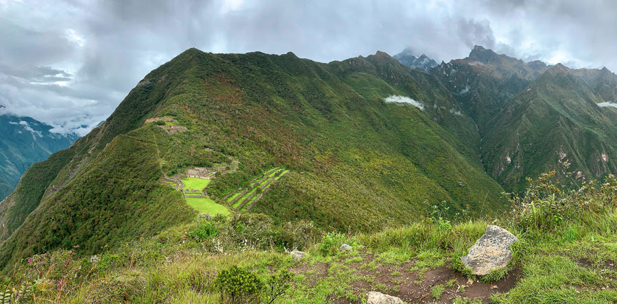
I was able to plot a 9-day trek from Cusco to the incredible Inca site of Choquequirao and continue on to Machu Picchu. While people pay thousands of dollars to hike the Inca trail, I spent $225 USD on a trek that included sites that few tourists visit. I hiked a trail which felt like a real expedition and almost felt a little like Hiram Bingham.
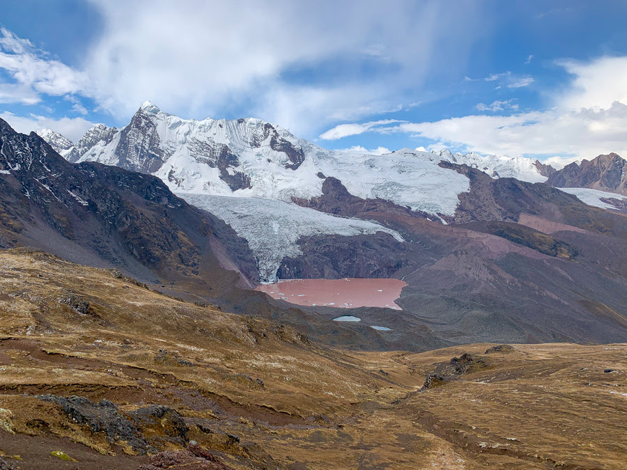
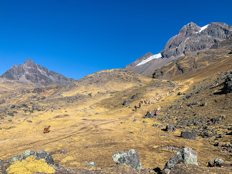
Another incredible route that was possible from Maps.me was the epic Ausangate trek in Peru. This high altitude trek never dips below 4,000 meters and continues to rank on the world’s best treks. I did a 6-day circuit for $55!
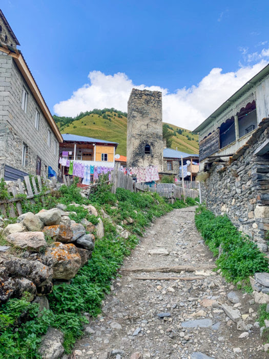
While exploring the incredible Caucus country of Georgia, I planned my own incredible Mestia to Ushguli trek in the Upper Svaneti Region. The trail is stunning and can be busy, but I was able to use some alternative routes thanks to Maps.me.
Besides multi-day treks, Maps.me help me discover tons of hidden gems in Peru, like the little-known alpine lake of Laguna Juchuycocha, Saywa Mountain, and the stunning Sun Gate near Ollantaytambo.
What About Bike Routes?
Yes, it’s super easy to plan biking adventures on Maps.me. The best thing is that Maps.me actually incorporates official bike paths and will direct you to them over car roads. The bike routes are shown in purple.
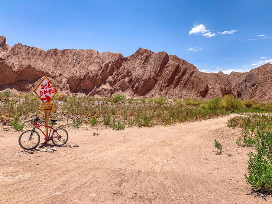
One of my favorite bike routes I planned with Maps.me was the lovely Catarpe Valley in the Atacama Desert, Chile.
So, Maps.Me over Google Maps?
Well, usually yes, but I guess it all depends on how you travel. For me, I love exploring the mountains and finding places that few people know about. Maps.me is incredible for planning off the beaten path hikes and bike routes. I find the city map features are constantly improving. I will say when it comes to tracking public transportation, if I have a sim card, I prefer Google Maps.
However, I only plan my treks and adventures with Maps.me.
Final Thoughts | How to Use Maps.me
In short, this is how to use Maps.me to help with trip planning. Maps.me is the best offline map and has so many incredible features. On top of trip planning, this guide shows how to use Maps.me for hiking and biking adventures. Now that you know how to use Maps.me, what are you waiting for? Go download this free app and change the way you see the world!
I have been using maps.me for a while and recommend to my friends. But this article really helps me a lot more which I didn’t learn before so I shared with my friends. And thank you for sharing your trips. To Peru is one of my resolutions.
One question: how do I know how far and the elevation when I hike by using maps.me
Thank you
Hi Katie! I’m glad you learnt useful things 🙂 so the distance and the elevation: when you choose your destination and you tap “route to” and choose the walking icon, the app will tell you how much time it should take, the distance, and the difference in height. A graph will show how the elevation goes up and down from departure to arrival. It’s not extremely detailed, but it’s something 🙂
I used maps.me on my trek to Everest Base Camp.
Started my trek from Lukla and had all my daily destinations bookmarked. So it was simply to go from one bookmark to the other each day.
This was a solo trek and planned to take 7 days from Lukla to base camp and 5 days back.
Maps.me never failed me in the Himalayas and I was so dependent on its performance and navigation. All the villages were clearly displayed on the map. It was flawless and made my trek so enjoyable.
Hi John! What an inspiring story, thank you for sharing it with us! 🙂
How do I select waypoint marker color ?
Hi Philip! After you save a place as your favourite, select it again and on the right side of the screen there will be a small pencil. Tap it and you will be able to change color, bookmark name, description and category. Is this what you meant with “waypoint”? I hope this was helpful.
Very good write up! Fortunately I got hooked onto it from early days and have used it in China, US, Australia NZ and even the Rockies in Canada and last month was a life saver in the chaos of Cairo. In UK, this is my main tool to plan walks and hikes and it never stops to amaze me with kind of details you can not find in any other app let alone a free one. Mrs and I were once kind of ‘lost’ on a hill near Toronto and my Map.me showed a set of chevrons indicating some kind of steps close by – this turned out to be about 30 logs arranged in a semi circular spiral stair case that brought us down to the route leading down hill.
By the way do you know if the people behind it are still supporting it?
Hey Mohammad! Awesome stories 🙂 I’m really happy Maps.me was so helpful to you! Unfortunately I don’t know who supports it.
I love this app and have used it all over the world. Is there any way to eliminate the churches when you search “sights”?
Hi Rose! Sorry, I don’t know how to do that.
I have used this app in lots of countries with various modes of movement. Love it.
I often book the fist nights stay in a new destination, look it up on my app, save the location. Then when the bus, train stops I have an idea on direction and distance. And start walking generally no mater how far. Then once away from drop off point I look for a taxi. Way cheaper and often saves a ton of cash.
I wish I was able to save routes that I have created earlier
Hi Jp! I’m really happy to read your experience with Maps.me, it’s inspiring and useful! Keep it up 🙂
Hey,
I never heard of Maps.me before. Guess, I still have to learn many things about traveling. Thank you for sharing a lot of information about the app. I’m planing to travel around the world someday and this is really helpful! 🙂
There is always something new to learn! I hope you will use maps.me a lot during your explorations 🙂
Ooh this is awesome, definitely going to give this a shot.
Let me know what you like best! 🙂